AI/ML
Project Sevenhills
Three-stage deep learning inference pipeline for drone orthophotos
- Year
- 2026
- Role
- Lead Pipeline & CV Developer
- Context
- Ministry of Panchayati Raj (MoPR)
- Status
- Completed
Overview
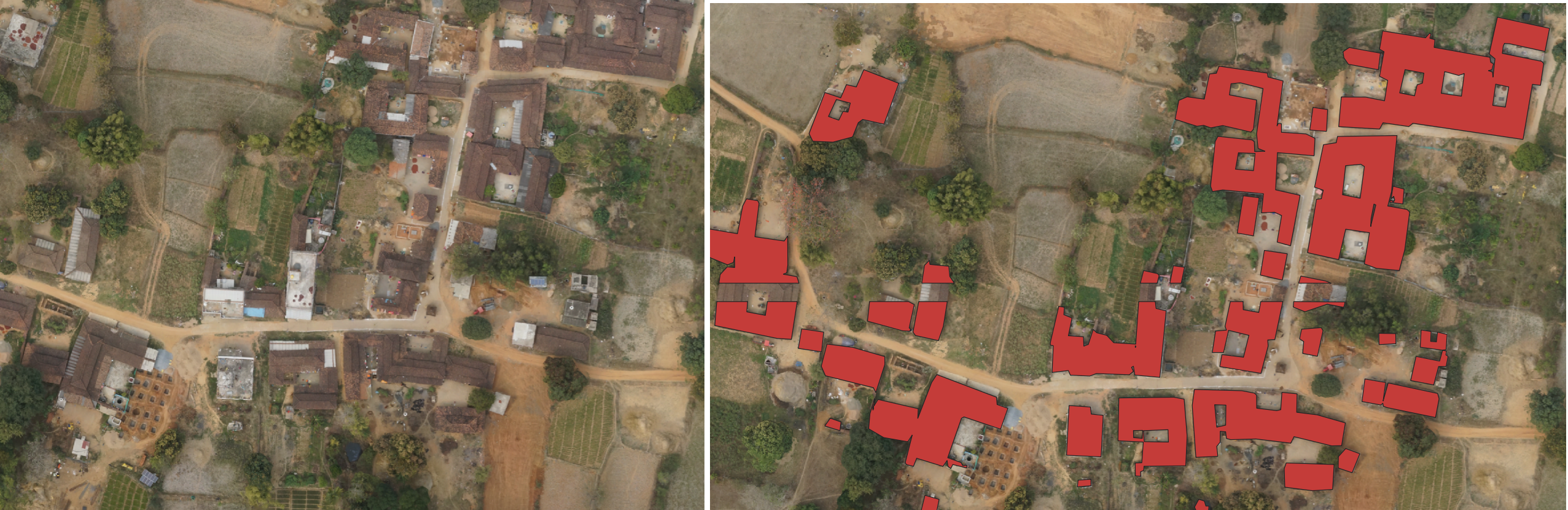
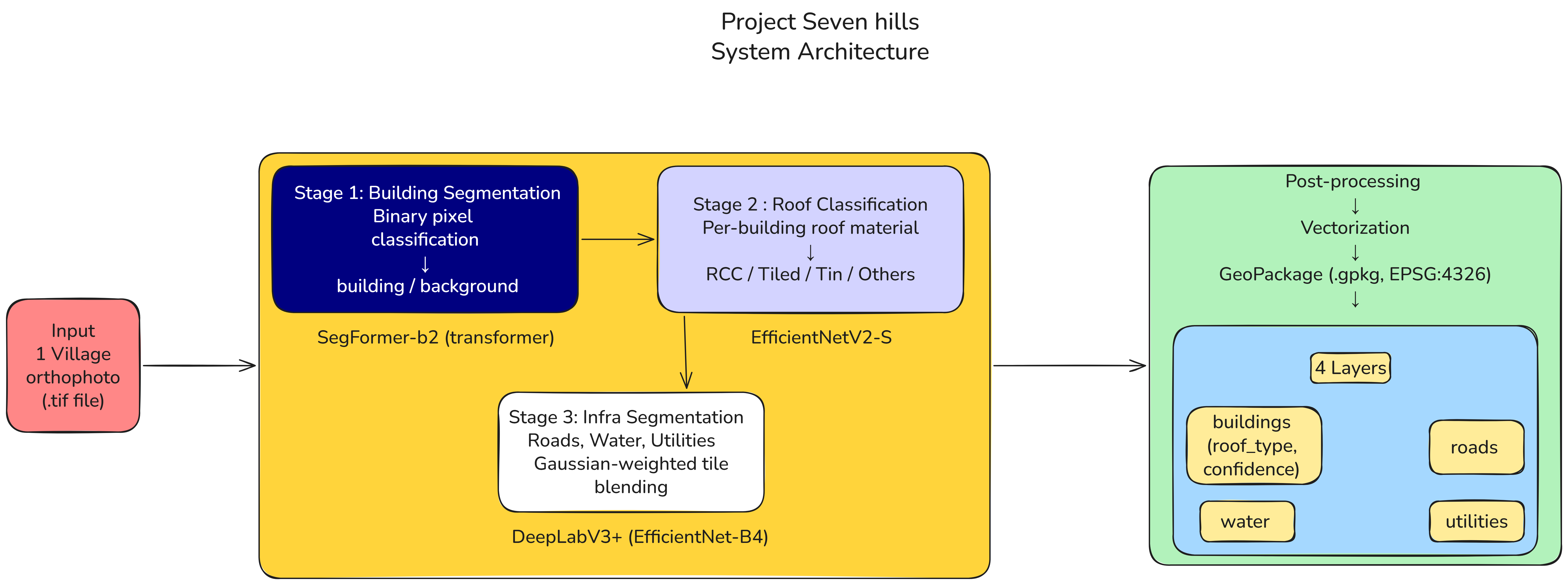
Project Sevenhills is a high-throughput geospatial deep learning pipeline engineered to ingest massive, high-resolution raw drone orthophotos and generate survey-grade OGC-compliant GeoPackages with 4 distinct vector feature layers.
Built in collaboration with the Ministry of Panchayati Raj (MoPR), the system automates rural asset mapping and boundary demarcations at land-record accuracy, dramatically reducing manual GIS digitization overhead.
Key Highlights
What makes it standout
- Three-stage automated inference pipeline: orthophoto tiling, computer vision segmentation, and GIS layer vectorization
- Generates OGC-compliant GeoPackages with 4 clean vector feature layers directly consumable by QGIS and ArcGIS
- Handles gigapixel aerial drone captures with memory-bounded chunking and edge artifact suppression
- Custom post-processing scripts for polygon polygonization, smoothing, and topological validation
System Design
Architecture & Pipeline
Technologies & Tools
PythonPyTorchComputer VisionGeoPandasGDALShapelyDockerQGIS


